

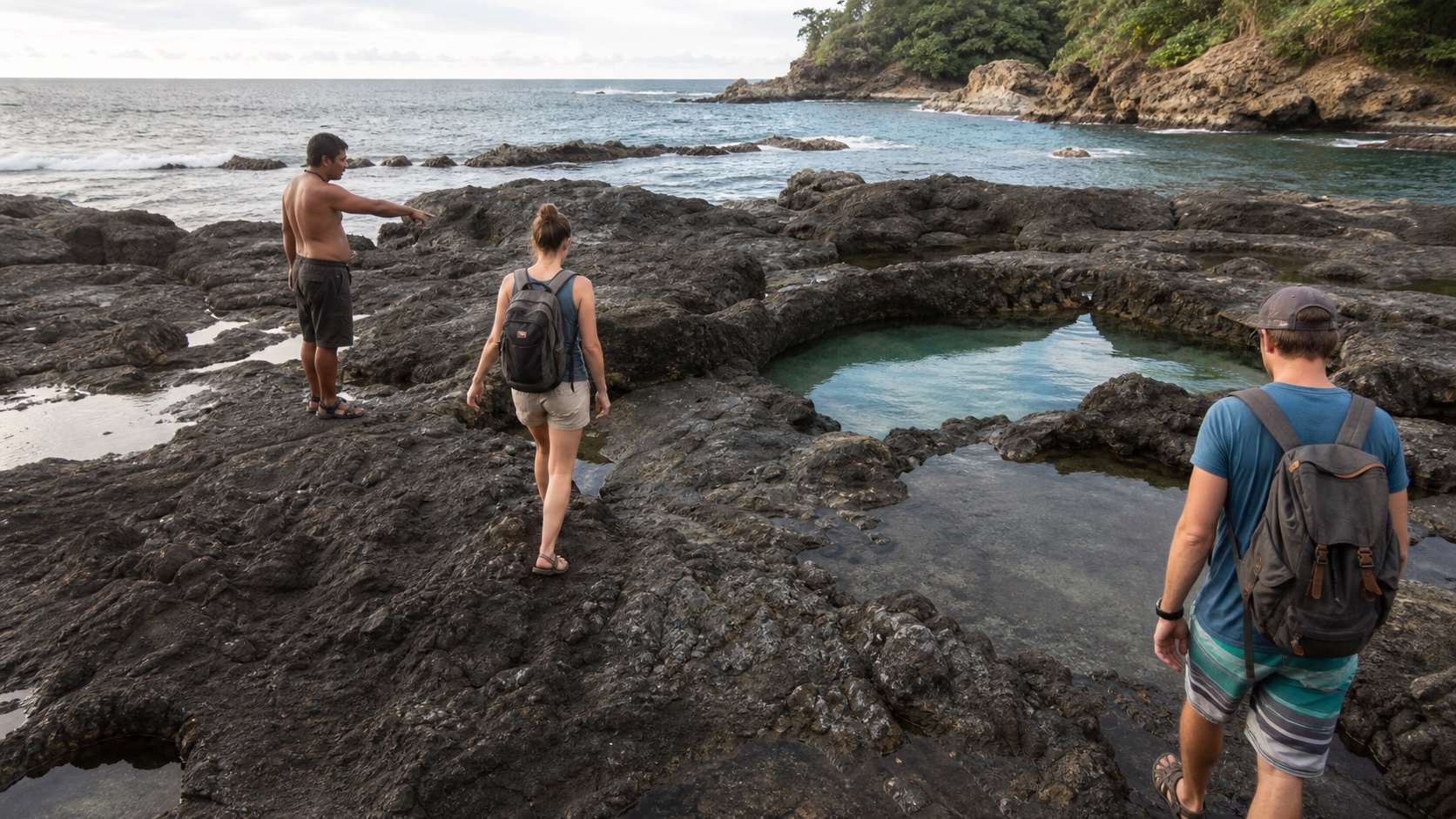
The Mal País tide pools are exposed rock pools on an active Pacific shoreline, not a managed swimming attraction. The useful route starts by traveling south from Playa Carmen into Mal País and orienting toward the Mar Azul coastal area, but the safe visit starts earlier: check the day's tide, swell, weather, daylight and return before leaving.
Plan around a low-water window rather than a fixed hour copied from another traveler's post. Tide times move every day, while swell can send water over rocks even near low tide. Old directions may also describe informal tracks or parking that have changed, so use current signs, public access and on-site local guidance. Turn back whenever waves reach the approach.
Quick Answer: How Do You Get to the Mal País Tide Pools?
From Playa Carmen, follow the main road south into Mal País. Older local directions identify the Mar Azul sign or access area, then describe continuing toward the coast and walking left along the shoreline to the rock pools. Treat that as orientation, not a guaranteed turn-by-turn route: signs, road condition, parking and public access can change.
Check a current Mal País tide table and arrive with enough time to observe the coast before the lowest water. The safest usable window depends on swell and the exact rocks, not only the printed low-tide minute. If water is crossing the route, waves are striking the pool edge, visibility is poor or you cannot identify an easy exit, do not continue.
A taxi or suitable rental vehicle is normally more practical than walking from central Santa Teresa. Bimba's published station directory does not list a parking point at the pools. End a Bimba ride only where the live app allows, never at an unapproved coastal track, and use another form of transport when the destination lies outside the operating boundary.
What Are the Mal País Tide Pools?
The pools form where receding seawater remains in depressions along Mal País's rocky shoreline. Their size, depth, temperature and connection to the ocean change with the tide and recent wave action. A pool that looked like a calm natural bath in a photograph may be shallow, surging, occupied by marine life or fully covered when you arrive.
Mal País is the southern neighbor of Playa Carmen and Santa Teresa, with a rockier and more dispersed coastal character. The tide pools belong to that landscape; they are not a constructed spa, ticketed park or supervised municipal swimming facility. There may be no lifeguard, shade, rail, changing room or reliable phone signal at the exact access.
This page owns the timing, safety and trip-planning intent. For choosing between sandy beaches, use the best beaches in Santa Teresa guide. For the full coastal map and Bimba station orientation, use the Playa Santa Teresa destination guide.
The Most Important Step: Check Tide and Swell Together
Low tide exposes more rock, but ‘go at low tide’ is incomplete advice. A long-period swell can send powerful sets across exposed platforms even when the water level is low. Wind, rain and localized wave direction can further change footing and visibility.
Use a current source such as the Mal País tide chart, then compare it with a current marine or surf forecast. Note which station the tide source uses and remember that a forecast is a model, not an observation of the exact pool.
Aim to arrive early enough to watch multiple wave sets and leave before the route begins to disappear. Do not create a universal ‘two hours before and after’ rule: the safe margin shrinks when swell is energetic and may vanish entirely.
| Check | What it tells you | Decision it cannot make for you |
|---|---|---|
| Low-tide time | When the predicted water level reaches its daily low | Whether waves are crossing a specific rock shelf |
| Tide height | How low or high that cycle is predicted to be | Whether the pool is deep or clear enough to enter |
| Swell height and period | Potential incoming wave energy | The exact impact at the access point |
| Wind and weather | Visibility, surface chop and storm risk | Whether your footwear and route are safe |
| On-site observation | What several real wave sets are doing now | What conditions will do much later |
Directions From Playa Carmen and Santa Teresa
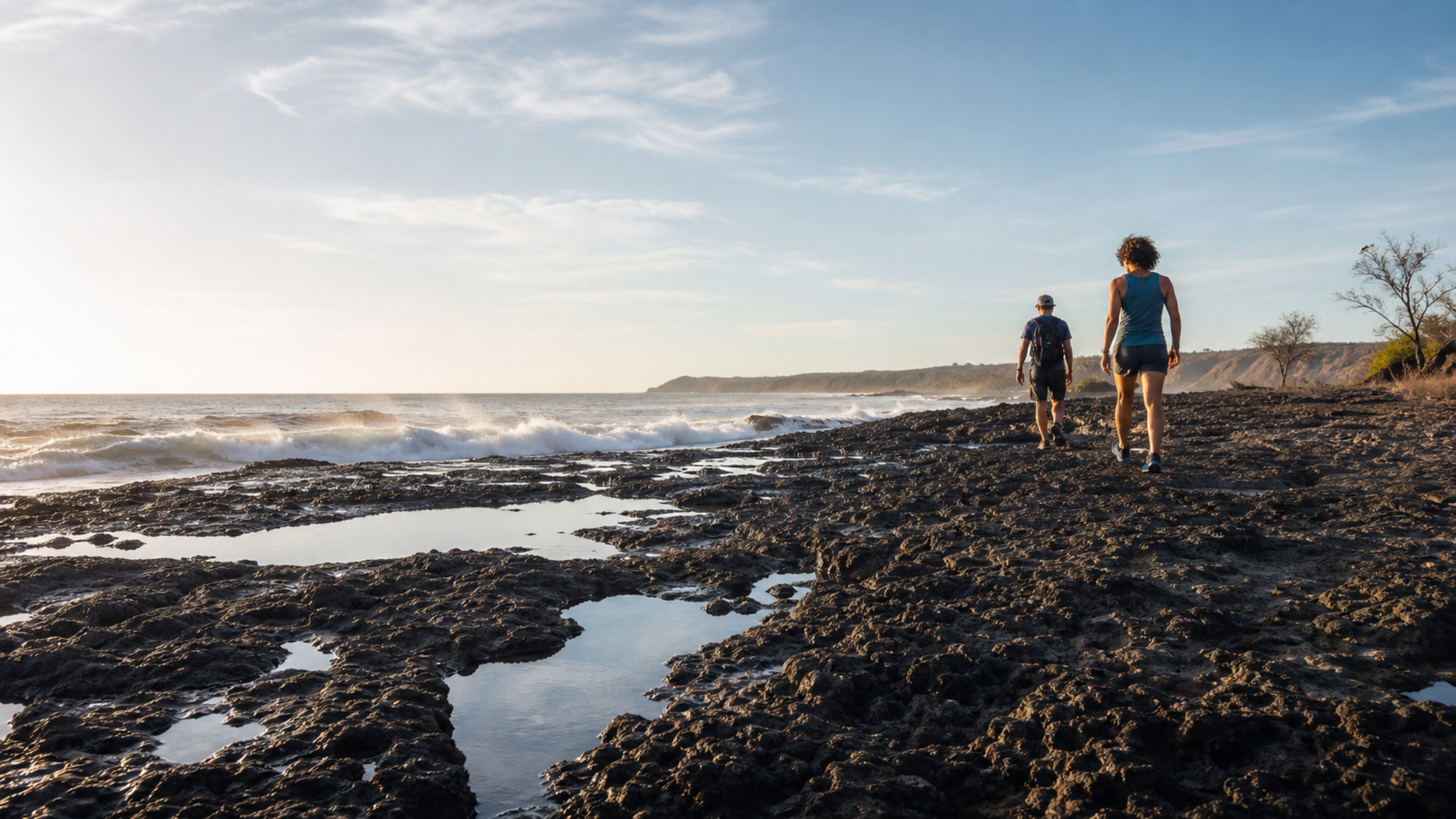
The practical road orientation is simple: travel south from the Playa Carmen crossroads toward Mal País. Commercial density decreases, the coastline becomes rockier and the fishing-village character becomes more visible. Save the accommodation pin and an offline map before leaving.
A long-established local description places the pools near the Mar Azul beach approach: turn toward the coast near the Mar Azul sign or recognized access, reach the beach area and continue left along the shoreline. A more recent visitor account similarly describes heading south, looking for the Mar Azul access and walking roughly 200 meters along the coast. These references agree on the general area but are not proof that an old track remains public or drivable.
Follow current public signs, ask a nearby established business or accommodation team, and stop if the route appears to enter a private driveway. Do not push past a gate, move a barrier or create roadside parking. A pin placed directly on the water may mark the pool rather than the legal entrance.

Choose Transport Before You Choose the Tide Window
A tide window is time-sensitive. Walking a long distance in heat can consume the useful period and leave you returning after dark. Public transportation within Mal País is limited, and the Costa Rica Tourism Board notes that the nearest bus point for Mal País is around the Playa Carmen junction rather than at every coastal destination.
A pre-arranged taxi is the simplest choice when nobody in the group wants to drive. Send the exact destination area, agree where the driver can safely stop, and book the return because a passing taxi may not appear near a quiet access. A rental car or ATV can work only when the contract permits the route, the driver is qualified and the parking area is clearly allowed.
Bimba can serve suitable short trips inside its live operating area, but the published website network should not be interpreted as a tide-pool station. Delizie is the southernmost business location on the current directory, and Creativo is another southern anchor farther north; neither is the pool entrance. Check the app, end only at an approved point and never ride onto beach sand or exposed rock.
| Option | When it fits | What to confirm |
|---|---|---|
| Pre-booked taxi | Time-sensitive visit without driving | Pickup pin, return time, fare and phone signal |
| Rental car | Group trip with permitted road access | Contract, road condition and legal parking |
| ATV or motorcycle | Experienced licensed rider on a permitted route | Helmet, insurance, surface and secure parking |
| Bimba | Only a suitable trip ending at an in-app approved location | Live boundary and remaining walk; never assume pool access |
| Walking | Only from genuinely nearby accommodation in daylight | Heat, distance, roadside exposure and return |
How to Use Bimba for a Mal País Tide-Pool Trip
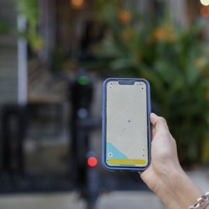
Bimba can help with the paved or established-road portion of a suitable daytime trip, but the tide pools themselves are not an approved Bimba parking location. Before unlocking, open the live app and confirm three things: the active service boundary reaches the station you intend to use, that station is currently eligible for ending the ride, and the remaining distance to the public coastal access is realistic for your group.
The two most useful southern anchors in Bimba's published 25-location directory are Creativo ART Center at 9.619187, -85.144540 and Delizie Italian Bakery & Kitchen at 9.603352, -85.140901. They sit on different sides of the wider Mar Azul area and should be treated as business parking anchors—not as proof of the closest legal beach entrance. Road geometry, gates and current public access matter more than straight-line distance.
| Bimba anchor | How it can fit the plan | What to verify before riding |
|---|---|---|
| Creativo ART Center | A southern Mal País-area endpoint when approaching from Playa Carmen or central Santa Teresa; useful if you plan to complete the final segment by walking only when the route is confirmed suitable, or by a pre-arranged taxi. | Live end-ride eligibility, remaining road distance, heat, daylight and whether the current public Mar Azul access can be reached without entering private property. |
| Delizie Italian Bakery & Kitchen | The southernmost business location in the published network; useful as a food, water or confirmed pickup anchor before or after a Mal País outing. | Whether it is offered in the live app for your ride, the direction of the final access, business-area parking instructions and the return plan. |
| The tide-pool access itself | Continue only on foot or with another suitable, legally parked vehicle after confirming the public route and ocean conditions. | There is no published Bimba parking point at the pools. Never leave a vehicle beside a track, on beach sand, against a gate or on exposed rock. |
Four practical trip ideas
- Bimba out, taxi back: ride in daylight to an eligible southern station, end and confirm the trip, then use a pre-arranged taxi for the final approach or return. This avoids depending on a vehicle being available after the tide window.
- Taxi to the pools, Bimba after lunch: use a taxi for the time-sensitive coastal visit, return to Delizie or Creativo, and open the app only then to see whether a suitable Bimba is available for a separate local trip.
- Short Bimba link from Playa Carmen: use Bimba only for the approved station-to-station segment, then walk the remainder only when distance, heat, footwear and roadside conditions are comfortable.
- Food-and-tide plan: schedule a confirmed stop near Delizie around the excursion. It creates a recognizable meeting point for the driver and a place to regroup without treating the natural shoreline as a mobility station.
Calculate the ride before choosing it
Bimba's current published pricing is US$1 to unlock plus US$0.50 per minute, or US$15 for a daily pass that includes 100 minutes. The live app remains the source of truth. A low-tide deadline makes reliability more important than saving a few dollars: include the walking segment, station availability and taxi fallback when comparing the total plan.
End the ride before starting the coastal walk. Confirm in the app that the trip is closed and the vehicle is stable inside the exact approved area. Do not pause a paid ride while exploring the pools, and do not leave a Bimba where another rider, business, pedestrian or emergency vehicle would be blocked.
For all 25 published locations and current station types, open the Bimba locations guide. Live vehicles, operating boundaries and eligible end points appear only in the Bimba app and can change during the day.
What to Pack for a Tide-Pool Visit
- Secure closed footwear or sandals with genuine wet-rock grip; smooth flip-flops are a poor choice.
- Drinking water and sun protection—the exposed rock can feel much hotter than the shaded road.
- A charged phone with the accommodation, driver and return pin saved offline.
- A small first-aid kit for minor cuts; leave and seek appropriate care for any significant injury.
- A dry bag only for items you truly need; do not rely on it as flotation equipment.
- Reef-conscious sunscreen and clothing that reduces the need for repeated application.
- No glass containers, speakers, unnecessary valuables or food packaging likely to blow away.
How to Read the Access Before Stepping Onto the Rocks
Stop at the edge and watch several full sets. Look for wet rock above the current waterline, fresh foam, channels that suddenly fill and people retreating when larger waves arrive. Dark, polished or algae-covered surfaces can be slippery even when they look dry from a distance.
Identify the exit before approaching a pool. The route back should remain obvious if the water rises or a person becomes tired. Never place the ocean behind you for a photograph, and never stand on the seaward rim because someone else did so safely moments earlier.
When conditions are uncertain, enjoy the view from stable ground. Turning back is a successful safety decision, not a failed excursion.
| What you observe | What it may mean | Best response |
|---|---|---|
| Waves washing across the approach | The route is exposed to active surf | Turn back immediately |
| Foam or water suddenly filling channels | Larger sets reach farther than average | Stay off the platform |
| Green or dark polished rock | Algae or constant moisture | Avoid; traction may be poor |
| Pool surging with each wave | It remains connected to ocean energy | Do not enter |
| Rising water narrowing the exit | The usable window is ending | Leave before the route closes |
| Thunder, heavy rain or fading light | Visibility and rescue margin are dropping | End the visit |
Entering a Pool Safely—When Conditions Allow
First decide whether entering adds value. Observing marine life and rock formations from the edge can be the better experience. If a pool appears separated from active surf, approach slowly, test every step and inspect the water for depth, sharp rock and animals before putting weight down.
Never jump or dive. Pool depth can be deceptive, and submerged rock does not move because a photograph made the water look deep. Sea urchins and other marine organisms may be present; do not touch, stand on or remove them.
Children require direct, arm's-reach supervision. An adult should not be simultaneously taking photographs, managing bags and supervising a child near moving water. If the group cannot maintain that level of attention, stay on the dry side.
When You Should Cancel the Visit
- The swell forecast or local advice indicates energetic, unpredictable surf.
- Waves are reaching the access rocks or pool edge.
- The predicted low tide occurs after dark or leaves too little daylight for the return.
- Heavy rain, lightning, poor visibility or runoff affects the coast.
- Nobody in the group has footwear with reliable grip.
- A child, older traveler or person with limited mobility cannot use the route comfortably.
- The public access or legal parking cannot be confirmed.
- Your return ride is unconfirmed and the area is too quiet to rely on finding transport.
- Any member of the group feels uncertain after seeing the real conditions.
Photography Without Creating Risk
The most dangerous moment is often not swimming but concentrating on a phone while standing on wet rock. Take photographs from a stable, landward position and keep the route and incoming sets visible. Use zoom instead of stepping closer to an exposed rim.
Do not ask another person to turn their back to the ocean, sit in a surging channel or climb above a pool for a dramatic composition. A dry bag does not protect a person from a wave, and losing a phone is never a reason to chase it toward the water.
Avoid geotagging an informal path if increased traffic could damage vegetation or encourage trespass. Name Mal País responsibly and link readers to current public-access guidance rather than publishing a fragile shortcut.
Marine Life and Leave-No-Trace Behavior
Tide pools are small ecosystems. Animals that tolerate changing temperature and salinity are still vulnerable to handling, sunscreen, litter and repeated feet. Observe crabs, fish, anemones, snails and urchins without moving them to improve a photograph.
Do not collect shells that may be homes, turn over rocks or pour drinks into the water. Apply sunscreen before reaching the pool when possible, wear protective clothing and avoid entering immediately after applying a heavy layer.
Carry out every item, including fruit peels, cigarette waste and broken footwear. Keep music low and leave room for local residents, fishers and other visitors to use the coast.
A Realistic Half-Day Plan
Start by checking tide, swell and weather the evening before, then check again in the morning. Confirm the driver and save the return details. Leave Santa Teresa or Playa Carmen with enough margin to arrive, orient and watch the sea before the planned low-water period.
Spend the first 15 minutes observing rather than entering. If conditions permit, explore only the stable, landward area and set a departure alarm well before the tide begins to compromise the route. Pair the outing with food in Mal País or Playa Carmen instead of crossing all the way to Hermosa the same day.
If the coast is unsafe, switch to the fallback: visit a nearby established business, enjoy a sandy beach from shore or return for another activity. The trip should not depend on forcing access to one natural feature.
Common Mistakes to Avoid
- Using yesterday's low-tide time; the tide schedule shifts daily.
- Checking tide but ignoring swell period and real wave sets.
- Following a map pin directly onto private property or an obsolete track.
- Arriving in flip-flops and assuming all exposed rock is dry.
- Depending on a ride-hailing app or passing taxi for the return.
- Calling the pools a guaranteed swimming or snorkeling location.
- Leaving bags unattended while everyone enters the water.
- Staying for sunset without enough light to cross the rocks and return.
- Confusing Playa Cuevas / Los Suecos with the Mar Azul tide-pool area.
Mal País Tide Pools FAQ
Where are the Mal País tide pools?
They are on the rocky Mal País coast south of Playa Carmen. Long-standing local directions orient visitors toward the Mar Azul access area, then left along the coast, but public access and parking must be verified locally.
What is the best time to visit?
Use a current low-tide window as the starting point, then confirm swell, weather and the actual rock exposure. There is no permanently safe clock time.
Can I swim in the pools?
Only consider entering a pool that is clearly separated from active waves and has known footing and depth. Never jump or dive, and stay out whenever water surges through it.
Are the tide pools suitable for children?
The exposed, uneven rock and changing ocean make this a high-supervision outing. Keep children within arm's reach and skip the approach when footing or water is uncertain.
Can I walk there from Santa Teresa?
It may look possible on a map, but heat, road conditions, distance and a changing tide window make a confirmed taxi or suitable vehicle more practical for most visitors.
Can I park a Bimba at the tide pools?
Do not assume so. End only at an approved location shown in the live Bimba app. The current website directory does not identify the pools as a Bimba parking point.
Are Playa Cuevas and the tide pools the same place?
No. Playa Cuevas, also called Los Suecos, is a separate cove farther south. The tide-pool directions discussed here refer to the rocky Mar Azul area.
Do I need a guide?
A guide is not universally required, but current local knowledge is valuable when access or conditions are uncertain. Never use a guide as a reason to ignore visible ocean risk.
Sources and Last Review
Access orientation was cross-checked against the long-established Malpais Beach tide-pool description, current Visit Costa Rica guidance for Santa Teresa and Mal País, the Costa Rica Tourism Board's Puntarenas guide and a current Mal País tide-table source. Older directions were retained only as general orientation and explicitly not treated as proof of current public access.
This guide was reviewed August 6, 2026. Tide, swell, weather, road condition, parking and coastal access are live variables. Send corrections with the page URL, the affected detail and a supporting source to hello@gobimba.com.
Bimba operates shared electric mobility locally and may benefit when readers use the service. The tide pools are not presented as a guaranteed Bimba destination; taxis or other suitable transport are recommended whenever the live boundary, road, weather, passengers or timing make a shared two-wheel trip inappropriate.